
The Ramara Historical Society was established to research, document, collect, classify, preserve and edit material illustrating the founding, settlement and development of the former townships of Rama and Mara, which is the geographical area now known as The Township of Ramara and the Chippewas of Rama First Nation.
Meetings
All meetings are open to the public and begin at 7:00 p.m. at the Udney Community Centre (Hwy. 12 east from Orillia to Concession Road 10, Ramara). Following the business portion of the meeting members share items linked to the monthly Heritage Theme and light refreshments are served.
Ramara Township
Ramara is a township municipality in Simcoe County, Ontario, Canada.
Location: Approx. 75 miles or 120 KM north of Toronto.
Total area: 419.2km
Population of Ramara Township: 9,275 (2011)
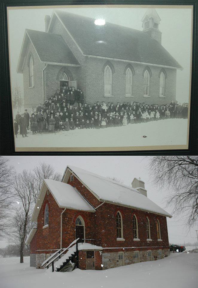
CLICK TO EXPAND PHOTO
Thanks to Robert Loney for this old historic picture of Atherley Church, compared to a more recent one. Both these photos are of the west side of the Church and that the stairs and the open door lead to the stairwell from which you were able go down to the kitchen and can still go straight ahead into the choir loft of the Church proper.
Ramara on the Map
Certificates of Authenticity
Contact Information
Geraldine Toebes
Position: Chairperson
email: Deenie134@gmail.com
Mary Reed
Position: Vice Chairperson
email: mmulvi123@gmail.com